Page 532 of 584
Holston River South Fork
View of the Holston River’s South Fork looking upstream. The land on the image’s right is today known as Ridgefields. A segment of the Greenbelt Trail now runs along the image’s left side. The former ferry that carried people across the river can be seen near the image’s center.
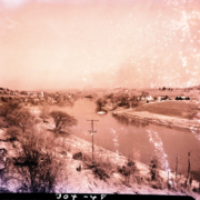
Type: KPT Archives
Miss Sullivan County Jeanette Conkin
Jeanette Conklin was crowned Miss Sullivan County.
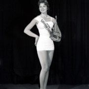
Type: KPT Archives
Sign for Ridgefields Road
Man with pipe hanging new sign for Ridgefields Road. In the background, there are a couple of cows but no buildings.
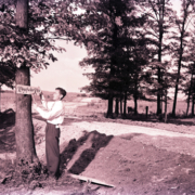
Type: KPT Archives
Damaged Building
This building owned by Tom Yancey had a collapsed roof. The structure was located along West Sullivan Street between Revere and Clay streets.
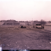
Type: KPT Archives
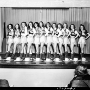
Kingsport Junior Auxiliary League Cabaret Group
Cabaret performance by the Kingsport Junior Auxiliary League.
Type: KPT Archives
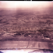
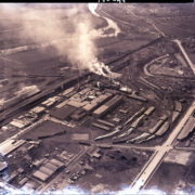
Cement Hill and Downtown
This view of Cement Hill (Holston Heights) and downtown Kingsport was taken from above Long Island. The industrial area to the left of Cement Hill was the Pennsylvania-Dixie Cement Corporation. The Riverview neighborhood is visible near the image’s right center.
Type: KPT Archives
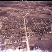
Highland Neighborhood
Aerial view of the Highland neighborhood looking to the North. A portion of Brooks Circle at the corner of Fort Henry Drive and North Eastman Road is visible in the lower left corner.
Type: KPT Archives
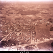
West View Neighborhood
Aerial view of Kingsport’s West View neighborhood. When this image was captured, the neighborhood had not yet been annexed into the city. The large building in the image’s lower right is today called Theodore Roosevelt Elementary School. In 1948 it was part of the Sullivan County School system and called West View Elementary School.
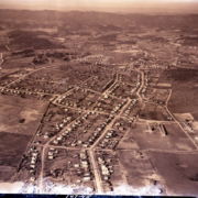
Type: KPT Archives
Page 532 of 584